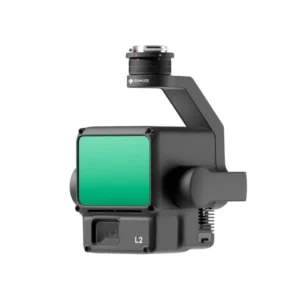
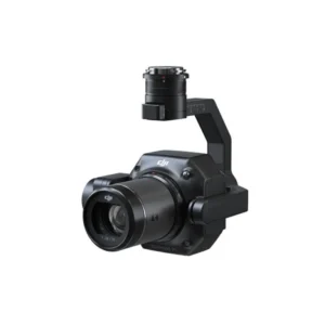
Payload: Payload at Drone Central provides efficient, secure solutions for carrying goods by drone. Designed for stability and performance, our systems handle packages, cameras, and sensors, maximizing drone capabilities across various industries.
-
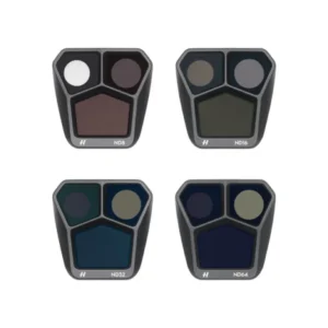
DJI Mavic 3 Pro ND Filter Set (ND8163264)
-
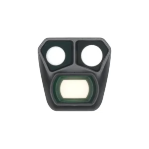
DJI Mavic 3 Pro Wide-Angle Lens
-
Sale!
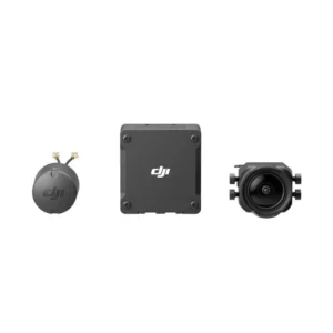
DJI O3 Air Unit
Original price was: ₹38,000.00.₹28,290.00Current price is: ₹28,290.00. -
Sale!
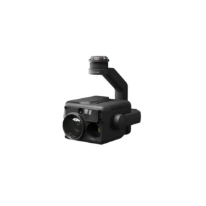
DJI Zenmuse H20N Drone Payload
Original price was: ₹930,000.00.₹920,000.00Current price is: ₹920,000.00. -
Sale!
DJI Zenmuse H20T Drone Payload
Original price was: ₹810,000.00.₹790,000.00Current price is: ₹790,000.00. -
Sale!
DJI Zenmuse L1 Lidar Drone Payload
Original price was: ₹893,000.00.₹875,000.00Current price is: ₹875,000.00. -
Sale!
DJI Zenmuse L2 Lidar Drone Payload
Original price was: ₹910,000.00.₹895,000.00Current price is: ₹895,000.00. -
Sale!
DJI Zenmuse P1 Drone Payload
Original price was: ₹575,000.00.₹560,000.00Current price is: ₹560,000.00.
Read More
Drone Payload: Expanding Possibilities in Aerial Technology
Drones have advanced from simple recreational devices to indispensable tools across industries, largely due to the flexibility of drone payloads—the equipment or sensors they carry. With payloads like cameras, LiDAR modules, and sensors, drones are now pivotal in agriculture, construction, surveying, public safety, and infrastructure inspection. These payloads enable high-quality data capture, precise mapping, and efficient monitoring of hard-to-reach areas. DJI is a leading provider in this space, offering payloads such as the Zenmuse H20 series, L1 and L2 LiDAR modules, and the P1 for detailed mapping. Let’s dive into how these payloads are reshaping industry capabilities.
Understanding Drone Payloads
Drone payload refers to any additional weight carried by a drone, whether it’s equipment for data collection or other operational tools. The primary goal of adding Gimbals is to expand a drone’s functional capabilities, but each type of Gimbal has unique characteristics and applications.
Typically, Gimbals are classified based on their function:
- Imaging payloads (e.g., high-resolution cameras for photography and videography)
- Thermal sensors for temperature mapping and search-and-rescue operations
- Multispectral sensors for agricultural analysis and environmental monitoring
- LiDAR modules for high-precision mapping and surveying
- Specialized equipment for inspections or hazardous-material handling
The right payload allows drones to be specialized for certain operations, maximizing their value in the field. However, capacity varies depending on the drone model, meaning a heavier requires a more powerful drone with greater stability.
DJI Zenmuse Payload Solutions
DJI has developed various payload options that have become industry standards for high-performance data capture. DJI’s Zenmuse series offers a range of specialized payloads that excel in different applications, including thermal imaging, LiDAR mapping, and photogrammetry. Here, we’ll explore the capabilities of DJI’s Zenmuse payload options.
DJI Zenmuse H20T: Thermal and Optical Sensing Powerhouse
The DJI Zenmuse H20T is a quad-sensor payload combining a 20MP zoom camera, a 12MP wide camera, a thermal imaging camera, and a laser rangefinder. Designed for search-and-rescue, firefighting, and security applications, the H20T provides extensive situational awareness in real-time. Key features include:
- Thermal imaging capabilities, ideal for detecting heat signatures and identifying people or animals in low-visibility environments.
- High-resolution zoom and wide-angle lenses for capturing images from a distance and creating detailed maps or surveys.
- Laser rangefinder which can accurately measure distances, making it useful for incident response, public safety, and construction.
The H20T’s combination of visual and thermal sensors allows operators to detect heat changes, pinpoint locations, and create highly detailed images in challenging environments. Its versatility has made it popular in industries requiring complex monitoring and emergency response.
DJI Zenmuse H20N: Night Vision for Challenging Conditions
The DJI Zenmuse H20N payload offers night vision capabilities, enabling drones to operate efficiently in low-light or completely dark environments. Equipped with both starlight-grade night vision and thermal sensors, the H20N is highly effective for nighttime surveillance, search-and-rescue, and inspections. Key features include:
- Starlight-grade night vision, which allows the payload to capture clear visuals even in extreme low-light conditions.
- Dual thermal and visual sensors, enhancing visibility and making it easier to spot anomalies in the environment.
- Enhanced zoom and stabilization, which make it an excellent choice for monitoring over long distances without sacrificing image quality.
The H20N is designed for tasks where night vision is essential, such as law enforcement, wildlife monitoring, and critical infrastructure inspections that must be conducted after hours. Its robust design enables drones to operate across a wider range of hours, providing flexibility to field teams working around the clock.
DJI Zenmuse L1 LiDAR: Precision Mapping and 3D Modeling
The DJI Zenmuse L1 payload incorporates LiDAR technology to provide high-accuracy 3D mapping and terrain modeling. LiDAR, which stands for Light Detection and Ranging, uses laser pulses to measure distances between the sensor and objects, generating precise point-cloud data. Key features of the Zenmuse L1 include:
- Real-time 3D mapping capabilities, which allow for the rapid collection and processing of geographic information.
- Integrated RGB camera for colorized point clouds, providing more informative and visually rich mapping outputs.
- Highly accurate positioning, critical for industries such as construction, mining, and urban planning, where precise measurements are essential.
The L1’s ability to create accurate, detailed 3D models in real time makes it ideal for surveyors, GIS professionals, and any organization that requires topographical data. By combining RGB data with LiDAR, the L1 produces comprehensive visual representations that enhance decision-making.
DJI Zenmuse L2 LiDAR: Enhanced Mapping for Greater Precision
Building on the capabilities of the L1, the DJI Zenmuse L2 LiDAR module offers even greater precision and range, tailored to extensive mapping needs across larger areas. While it shares similar technology to the L1, the L2 is optimized for top-tier survey accuracy. Key features include:
- Higher range and precision, making it suitable for more demanding surveying projects.
- Improved sensor integration, enhancing data clarity and accuracy over complex terrains.
- Streamlined workflow support, as the L2 works seamlessly with DJI’s mapping software for efficient data processing.
The L2 payload is perfect for applications requiring advanced LiDAR mapping, such as in-depth land surveying, archeological site mapping, and large-scale environmental studies.
DJI Zenmuse P1: Photogrammetry and Aerial Surveying Excellence
The DJI Zenmuse P1 is built for aerial surveying and photogrammetry, making it an ideal choice for high-resolution mapping. Equipped with a full-frame sensor, the P1 provides impressive image quality, even in demanding environments. Key features include:
- 45MP full-frame sensor, which captures ultra-high-definition images for detailed mapping.
- Global mechanical shutter, which ensures distortion-free images by eliminating rolling shutter effects during high-speed flights.
- Smart Oblique Capture feature, which efficiently captures oblique photos, reducing post-processing time.
The Zenmuse P1’s precision and efficiency make it perfect for industries like real estate, agriculture, and infrastructure inspection, where highly accurate data and detailed imagery are required. Its ability to capture vast areas in high detail allows users to perform large-scale mapping projects with minimal downtime.
The Impact of Drone Payloads Across Industries
DJI’s Zenmuse options empower drones for tasks from surveillance and inspection to mapping and environmental monitoring. The H20T’s thermal and laser capabilities support emergency response, while the L1 and L2 LiDAR modules excel in accurate terrain modeling for construction. This payload flexibility enables organizations to boost efficiency, reduce costs, and make informed, data-driven decisions across industries.
In the agricultural sector, multispectral and thermal sensors help farmers monitor crop health and soil conditions. The construction industry uses photogrammetry payloads like the Zenmuse P1 for site planning, while surveyors utilize LiDAR to create digital models for infrastructure planning. Drones equipped with night vision, such as the H20N, are also transforming security and wildlife monitoring by making it feasible to observe areas in the dark.
Choosing the Right Drone Payload
Selecting the best payload depends on the specific requirements of the task. For aerial mapping, photogrammetry payloads like the Zenmuse P1 offer accuracy and image quality, while for night-time operations, the H20N provides invaluable night vision capabilities. If accurate 3D modeling is a priority, LiDAR payloads such as the L1 and L2 are ideal. Understanding these options ensures that users can maximize the potential of their drones and complete tasks with greater precision and efficiency.
Conclusion
Drone payloads have revolutionized aerial technology, enabling precise, detailed task execution across industries. DJI’s Zenmuse payloads—H20N, H20T, L1, L2, and P1—offer versatile functionalities, supporting applications from public safety to environmental science. Choosing the right payload transforms drones into specialized, data-driven tools, greatly enhancing operational efficiency and capability in various professional sectors.
FAQ's
Where can I use drone payloads effectively?
Drone payloads are used across various industries such as construction, agriculture, public safety, and environmental monitoring. Payloads like thermal cameras, LiDAR modules, and high-resolution cameras enable drones to perform specific tasks like aerial mapping, crop analysis, and search-and-rescue operations.
What is the DJI Zenmuse H20T best used for?
The DJI Zenmuse H20T is ideal for tasks that require both thermal imaging and optical zoom capabilities, such as search-and-rescue missions, firefighting, and infrastructure inspections. Its multi-sensor setup allows for detailed imaging in various light conditions, making it suitable for complex field operations.
How does the DJI Zenmuse L1 LiDAR differ from traditional cameras?
Unlike traditional cameras that capture images, the DJI Zenmuse L1 uses LiDAR technology to produce precise 3D maps and terrain models by measuring distances with laser pulses. This makes it ideal for topographical mapping and surveying applications, providing accuracy and detail in complex landscapes.
Is the DJI Zenmuse P1 suitable for high-resolution mapping?
Yes, the DJI Zenmuse P1 is equipped with a 45MP full-frame sensor and is specifically designed for high-resolution photogrammetry. It captures detailed images for precise aerial mapping, making it ideal for industries like construction, real estate, and environmental research.
Can I get real-time 3D mapping with DJI payloads?
Yes, with DJI’s Zenmuse L1 and L2 LiDAR payloads, you can capture real-time 3D mapping data. These LiDAR modules are capable of processing and delivering accurate point-cloud data during flights, enabling surveyors to make instant assessments in the field.
