Description
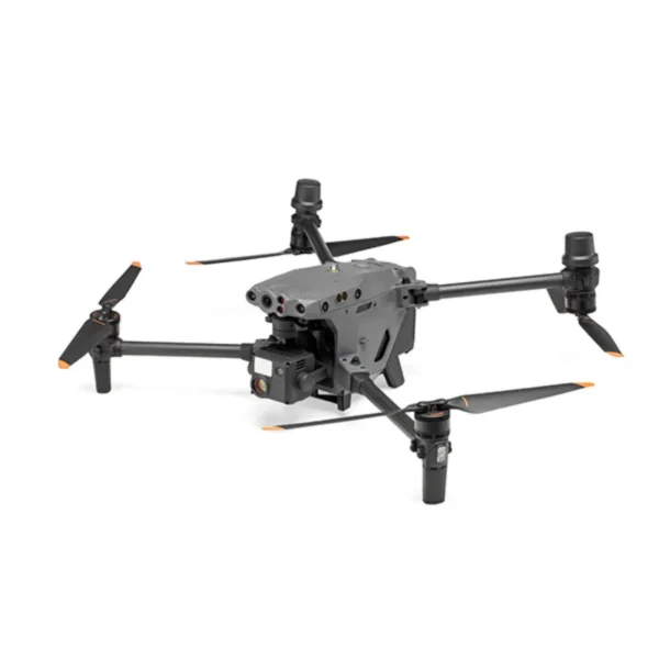
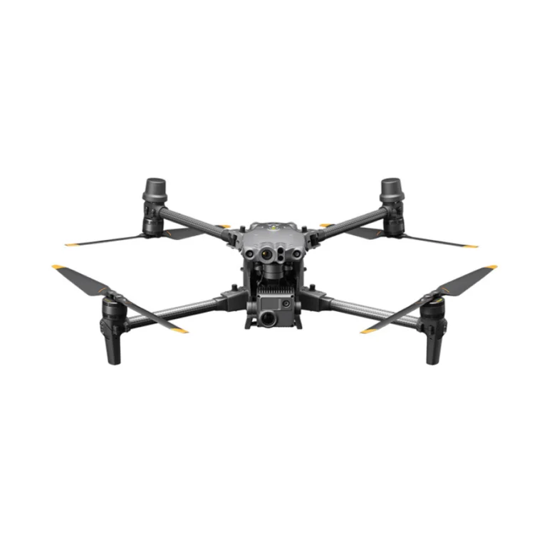
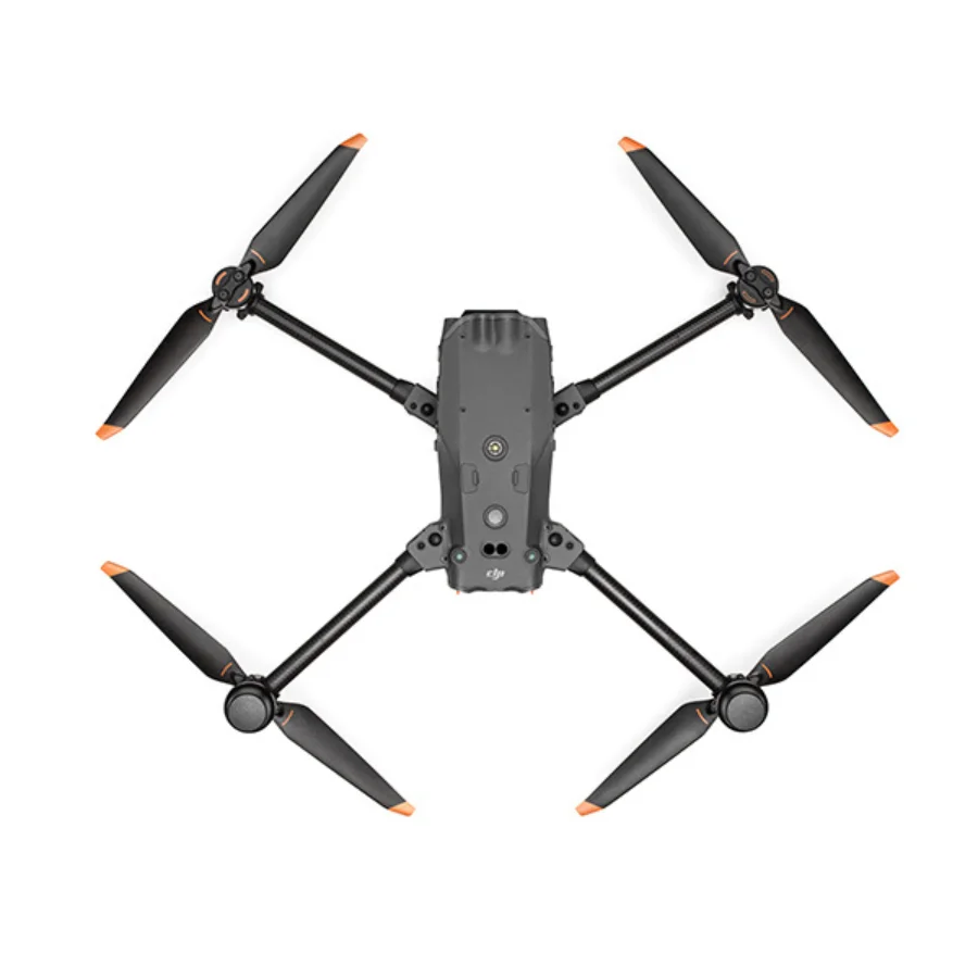
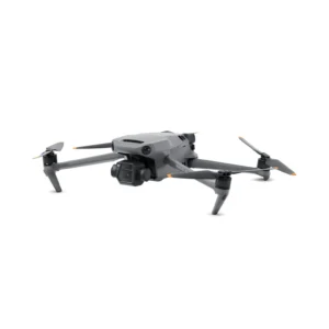
DJI M30 Drone Camera
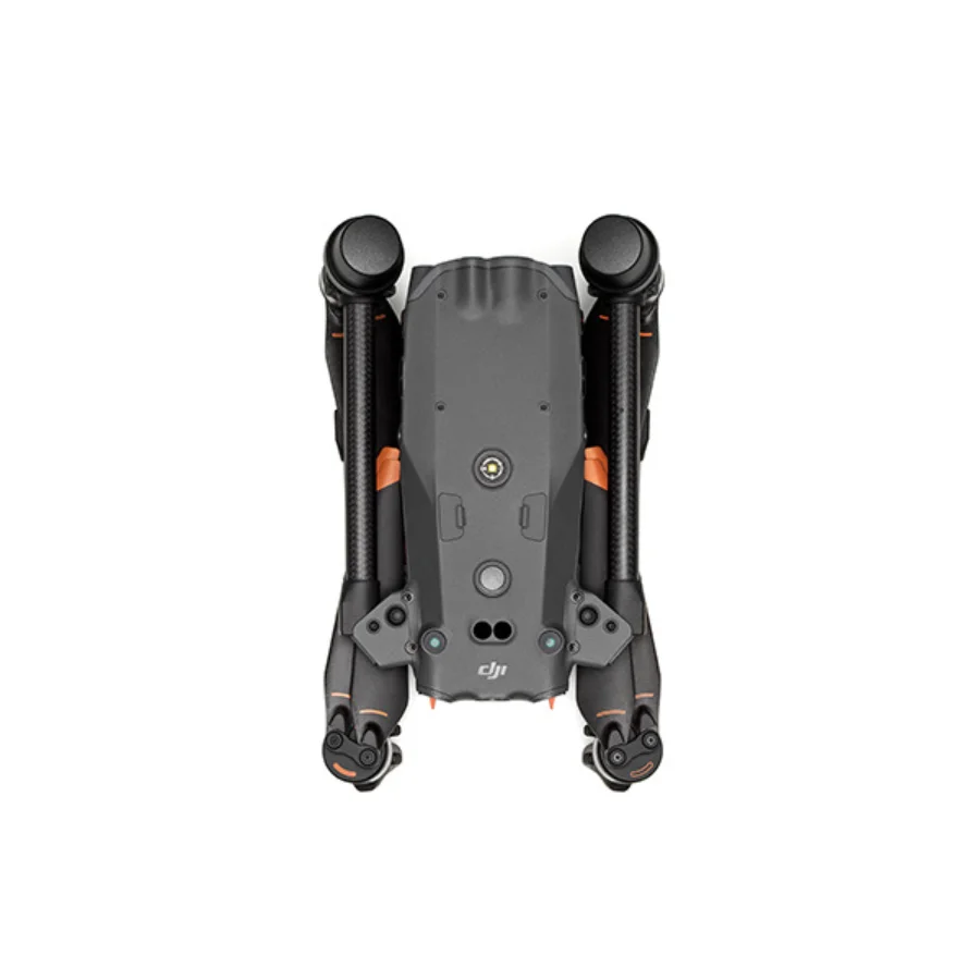
The DJI M30 is a high-performance drone camera designed for professional use in various industries such as public safety, inspection, and mapping. Equipped with a powerful quad-sensor payload, including a 12MP wide camera, 48MP zoom camera, thermal imaging sensor, and laser rangefinder, it offers unmatched versatility. The M30’s robust design is IP55-rated for weather resistance, making it suitable for challenging environments. With advanced AI capabilities, obstacle avoidance, and up to 41 minutes of flight time, the DJI M30 delivers precise data collection and reliable performance, making it an essential tool for complex aerial missions.

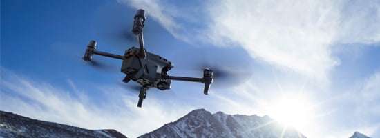
Safe & Reliable.
Enhanced Transmission

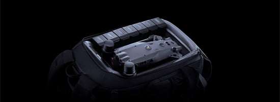
Capture Everything
Pro Flight Controller
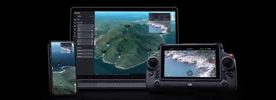
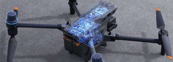
DJI Pilot 2
Ground to Cloud
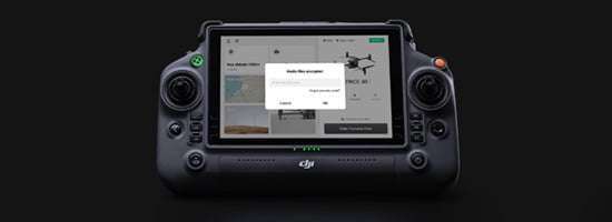

Advanced Intelligence
DJI Dock
Soecifications
Aircraft
-
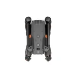
Dimensions
(unfolded, excl. propellers) - 470×585×215 mm (L×W×H)
-
Dimensions (folded)
- 365×215×195 mm (L×W×H)
-
Diagonal Wheelbase
- 668 mm
-
Weight (incl. two batteries)
- 3770 ± 10 g
-
Max Takeoff Weight
- 4069 g
-
Max Takeoff Weight for C2 Certification in EU
- 3998 g
-
Operation Frequency[1]
- 2.4000-2.4835 GHz; 5.725-5.850 GHz
-
Transmitter Power (EIRP)
- 2.4 GHz: <33 dBm (FCC); <20 dBm (CE/SRRC/MIC)
5.8 GHz: <33 dBm (FCC/SRRC); <14 dBm (CE)
-
Hovering Accuracy
(windless or breezy) - Vertical: ±0.1 m (Vision System enabled); ±0.5 m (N-mode with GPS); ±0.1 m (RTK)
Horizontal: ±0.3 m (Vision System enabled); ±1.5 m (N-mode with GPS); ±0.1 m (RTK)
-
RTK Positioning Accuracy
(fixed RTK enabled) - 1 cm+1 ppm (horizontal)
1.5 cm+1 ppm (vertical)
-
Max Angular Velocity
- Pitch: 150°/sec.; Yaw: 100°/sec.
-
Max Pitch Angle
- 35° (N-mode and Forward Vision System enabled: 25°)
-
Max Ascent/Descent Speed
- 6 m/s, 5 m/s
-
Max Tilt Descent Speed
- 7 m/s
-
Max Horizontal Speed
- 23 m/s
-
Max Service Ceiling Above Sea Level (without other payload)
- 5,000 m (with 1671 propellers)
7,000 m (with 1676 propellers)
-
Max Wind Resistance
- 12 m/s
-
Max Hover Time [2]
- 36 min
-
Max Flight Time[2]
- 41 min
-
Motor Model
- 3511
-
Propeller Model
- 1671
1676 High Altitude (not included)
-
Ingress Protection Rating[3]
- IP55
-
GNSS
- GPS+Galileo+BeiDou+GLONASS
(GLONASS is supported only when RTK module is enabled)
-
Operating Temperature
- -20° to 50° C (-4° to 122° F)
-
Class
- C2 (EU)
Gimbal
-
Angular Vibration Range
- ±0.01°
-
Controllable Range
- Pan: ±90°
Tilt: -120° to +45°
-
Mechanical Range
- Pan: ±105°
Tilt: -135° to +60°
Roll: ±45°
Zoom Camera
-
Sensor
- 1/2″ CMOS, Effective pixels: 48M
-
Lens
- Focal length: 21-75 mm (equivalent: 113-405 mm)
Aperture: f/2.8-f/4.2
Focus: 5 m to ∞
-
Exposure Compensation
- ±3 ev (using 1/3 ev as step length)
-
Electronic Shutter Speed
- Auto Mode:
Photo: 1/8000-1/2 s
Video: 1/8000-1/30 s
M Mode:
Photo: 1/8000-8 s
Video: 1/8000 -1/30 s
-
ISO Range
- 100-25600
-
Max. Video Resolution
- 3840×2160
-
Max Photo Size
- 8000×6000
Wide Camera
-
Sensor
- 1/2″ CMOS, Effective pixels: 12M
-
Lens
- DFOV: 84°
Focal length: 4.5 mm (equivalent: 24 mm)
Aperture: f/2.8
Focus: 1 m to ∞
-
Exposure Compensation
- ±3 ev (using 1/3 ev as step length)
-
Electronic Shutter Speed
- Auto Mode:
Photo: 1/8000-1/2 s
Video: 1/8000-1/30 sM Mode:
Photo: 1/8000-8 s
Video: 1/8000-1/30 s
-
ISO Range
- 100-25600
-
Max. Video Resolution
- 3840×2160
-
Photo Size
- 4000×3000
Thermal Camera
-
Thermal Imager
- Uncooled VOx Microbolometer
-
Lens
- DFOV: 61°
Focal length: 9.1 mm (equivalent: 40 mm)
Aperture: f/1.0
Focus: 5 m to ∞
-
Noise Equivalent Temperature Difference (NETD)
- ≤50 mK@F1.0
-
Infrared Temperature Measurement Accuracy[4]
- ±2°C or ±2% (using the larger value)
-
Video Resolution
- Infrared Image Super-resolution Mode: 1280×1024
Normal Mode: 640×512
-
Photo Size
- Infrared Image Super-resolution Mode: 1280×1024
Normal Mode: 640×512
-
Pixel Pitch
- 12 um
-
Temperature Measurement Method
- Spot Meter, Area Measurement
-
Temperature Measurement Range
- High Gain Mode: -20° to 150° C (-4° to 302° F)
Low Gain Mode: 0° to 500° C (32° to 932° F)
-
Temperature Alert
- Supported
-
Palette
- White Hot/Black Hot/Tint/Iron Red/Hot
Iron/Arctic/Medical/Fulgurite/Rainbow 1/Rainbow 2
FPV Camera
-
Resolution
- 1920×1080
-
DFOV
- 161°
-
Frame Rate
- 30 fps
Laser Module
-
Wavelength
- 905 nm
-
Max Laser Power
- 3.5 mW
-
Single Pulse Width
- 6 ns
-
Measurement Accuracy
- ± (0.2 m + D×0.15%)
D is the distance to a vertical surface
-
Measuring Range
- 3-1,200 m (0.5×12 m vertical surface with 20% reflectivity)
-
Safety Regulation Level
- Class 1M
-
Accessible Emission Limit (AEL)
- 304.8 nJ
-
Reference Aperture
- 18mm length, 18mm width (20.3mm diameter if equivalent to circular)
-
Max Laser Pulse Emission Power Within 5 Nanoseconds
- 60.96 W
Vision Systems
-
Obstacle Sensing Range
- Forward: 0.6-38 m
Upward/Downward/Backward/Sideward: 0.5-33 m
-
FOV
- 65° (H), 50° (V)
-
Operating Environment
- Surfaces with clear patterns and adequate lighting (> 15 lux)
Infrared Sensing Systems
-
Obstacle Sensing Range
- 0.1 to 10 m
-
FOV
- 30°
-
Operating Environment
- Large, diffuse, and reflective obstacles (reflectivity >10%)
TB30 Intelligent Flight Battery
-
Capacity
- 5880 mAh
-
Voltage
- 26.1 V
-
Battery Type
- Li-ion 6S
-
Energy
- 131.6 Wh
-
Net Weight
- Approx. 685 g
-
Operating Temperature
- -20° to 50° C (-4° to 122° F)
-
Storage Temperature
- 20° to 30° C (68° to 86° F)
-
Charging Temperature
- -20° to 40° C (-4° to 104° F)
(When the temperature is lower than 10° C (50° F), the self-heating function will be automatically enabled. Charging in a low temperature may shorten the lifetime of the battery)
-
Chemical System
- LiNiMnCoO2
Auxiliary Lights
-
Effective Illumination Distance
- 5 m
-
Illumination Type
- 60 Hz, solid glow
Remote Controller
-
Screen
- 7.02 inch LCD touchscreen, with a resolution of 1920×1200 pixels, and high brightness of 1200 cd/m2
-
Internal Battery
- Type: Li-ion (6500 mAh @ 7.2 V)
Charge Type: Supports battery station or USB-C charger maximum rated power 65W (max voltage of 20V)
Charge Time: 2 hours
Chemical System: LiNiCoAIO2
-
External Battery(WB37 Intelligent Battery)
- Capacity: 4920 mAh
Voltage: 7.6 V
Battery Type: Li-ion
Energy: 37.39 Wh
Chemical System: LiCoO2
-
Operating Time[5]
- Internal Battery: Approx. 3 hours 18 min
Internal Battery + External Battery: Approx. 6 hours
-
Ingress Protection Rating[3]
- IP54
-
GNSS
- GPS+Galileo+BeiDou
-
Operating Temperature
- -20° to 50° C (-4° to 122° F)
O3 Enterprise
-
Operating Frequency[1]
- 2.4000-2.4835 GHz, 5.725-5.850 GHz
-
Max Transmission Distance (unobstructed, free of interference)
- 15 km (FCC); 8 km (CE/SRRC/MIC)
-
Max Transmission Distance (with interference)
- Strong Interference (urban landscape, limited line of sight, many competing signals): 1.5-3 km (FCC/CE/SRRC/MIC)
Medium Interference (suburban landscape, open line of sight, some competing signals): 3-9 km (FCC); 3-6 km (CE/SRRC/MIC)
Weak Interference (open landscape abundant line of sight, few competing signals): 9-15 km (FCC); 6-8 km (CE/SRRC/MIC)
-
Transmitter Power (EIRP)
- 2.4 GHz: <33 dBm (FCC); <20 dBm (CE/SRRC/MIC)
5.8 GHz: <33 dBm (FCC); <14 dBm (CE); <23 dBm (SRRC)
Wi-Fi
-
Protocol
- Wi-Fi 6
-
Operating Frequency[1]
- 2.4000-2.4835 GHz; 5.150-5.250 GHz; 5.725-5.850 GHz
-
Transmitter Power (EIRP)
- 2.4 GHz: <26 dBm (FCC); <20 dBm (CE/ SRRC/MIC)
5.1 GHz: <26 dBm (FCC); <23 dBm (CE/ SRRC/MIC)
5.8 GHz: <26 dBm (FCC/SRRC); <14 dBm(CE)
Bluetooth
-
Protocol
- Bluetooth 5.1
-
Operating Frequency
- 2.4000-2.4835 GHz
-
Transmitter Power (EIRP)
- <10 dBm
BS30 Intelligent Battery Station
-
Dimensions
- 353×267×148 mm
-
Net Weight
- 3.95 kg
-
Compatible Battery Type
- TB30 Intelligent Flight Battery
WB37 Intelligent Battery
-
Input
- 100-240 VAC, 50/60 Hz
-
Output
- TB30 Battery Port: 26.1 V, 8.9 A (supported up to two outputs simultaneously)
WB37 Intelligent Battery: 8.7 V, 6 A
-
Output Power
- 525 W
-
USB-C port
- Max. output power of 65 W
-
USB-A port
- Max. output power of 10 W (5 V, 2 A)
-
Power Consumption (when not charging battery)
- < 8 W
-
Output Power (when warming up battery)
- Approx. 30 W
-
Operating Temperature
- -20° to 40° C (-4° to 104° F)
-
Ingress Protection Rating[3]
- IP55 (with the cover closed properly)
-
Charging Time[6]
- Approx. 30 min (charging two TB30 batteries from 20% to 90%)
Approx. 50 min (charging two TB30 batteries from 0% to 100%)
-
Protection Features
- Anti-Backflow Protection
Short Circuit Protection
Over Voltage Protection
Over Current Protection
Temperature Protection
- What are the key features of the DJI M30 Drone Camera?
The DJI M30 Drone Camera offers wide and zoom lenses, a laser rangefinder, 360-degree obstacle avoidance, and seamless integration with enterprise tools. - What is the flight time of the DJI M30 Drone Camera?
The DJI M30 Drone Camera provides up to 41 minutes of flight time, depending on conditions and payload. - What cameras are integrated into the DJI M30 Drone Camera?
The M30 integrates wide-angle, zoom, and laser rangefinder cameras, offering versatility for detailed aerial data collection. - What is the range of the DJI M30 Drone Camera?
The DJI M30 Drone Camera has a maximum operation range of up to 7 km, offering reliable long-range connectivity. - Is the DJI M30 Drone Camera weather-resistant?
Yes, the DJI M30 Drone Camera is IP55-rated, providing strong resistance against dust, water, and harsh weather conditions. - What temperature range can the DJI M30 Drone Camera operate in?
The DJI M30 Drone Camera is resilient in temperatures ranging from -35℃ to 50℃, making it suitable for extreme environments. - How does the DJI M30 Drone Camera handle obstacle avoidance?
The M30 is equipped with dual-vision and ToF sensors on all six sides for comprehensive 360-degree obstacle detection and avoidance. - What transmission technology does the DJI M30 Drone Camera use?
The M30 utilizes OcuSync 3 Enterprise, enabling triple-channel 1080p video transmission and seamless switching between input feeds. - Is the DJI M30 Drone Camera compatible with the DJI RC Plus controller?
Yes, the M30 is designed to work seamlessly with the DJI RC Plus controller, featuring a 7-inch widescreen and dual control mode. - How does the DJI M30 Drone Camera integrate with FlightHub 2?
The M30 syncs flight routes and mission data with FlightHub 2, allowing for unified management, cloud mapping, and real-time site overviews. - What is the DJI Dock (M30 Series Dock Version) used for?
The DJI Dock provides automated takeoff, landing, and charging for the M30, enabling remote operations with a range of up to 7 km. - What sensors are included in the DJI M30 Drone Camera?
The M30 includes wide-angle, zoom, and laser rangefinder sensors, along with ADS-B for real-time alerts of nearby aircraft. - What is the maximum zoom capability of the DJI M30 Drone Camera?
The M30 offers a powerful zoom capability, combining optical and digital zoom to provide detailed visuals from a distance. - Can the DJI M30 Drone Camera perform thermal imaging?
Yes, the M30 integrates thermal imaging for operations requiring heat detection, ideal for inspections and search-and-rescue missions. - How does the DJI M30 Drone Camera handle data management?
The M30 works with Pilot 2 and FlightHub 2, where media files, flight logs, and mission data can be automatically uploaded for easy management. - What industries is the DJI M30 Drone Camera suitable for?
The M30 is ideal for public safety, infrastructure inspection, energy, mapping, and emergency response applications. - What is the charging time for the DJI M30 Drone Camera?
The M30 features rapid charging with the DJI Dock, reducing downtime and enabling continuous operations. - How portable is the DJI M30 Drone Camera?
The M30’s foldable design and lightweight build make it highly portable, allowing for quick deployment in the field. - What is the advantage of the DJI M30 Drone Camera’s ADS-B receiver?
The built-in ADS-B receiver provides real-time warnings of incoming aircraft, enhancing flight safety in busy airspaces. - Does the DJI M30 Drone Camera support cloud-based mapping?
Yes, the M30 integrates with FlightHub 2 for fast cloud mapping in RGB or infrared, enabling quick terrain awareness and site overview.


There are no reviews yet.